Tram Padova · Free · iPhone & iPad · iOS 18.6 or later
Where the tram is,
and when it gets to you.
Tram Padova follows the Padua tram, the SIR1 line from Guizza to Pontevigodarzere, in real time. Open it and the stop nearest to you is already selected, with the next trams and their delay. Switch to the map and the vehicles move along the line as they move through the city, each with its number, and any stop is one tap from walking directions.
Free, in English and Italian, with no account and no advertising. It has been on the App Store since 2010 and was rewritten in 2026 around the operator's public real-time feed.
Version 3.3 · English and Italian · Free, no in-app purchases
No account · No analytics · No tracking · Location stays on the phone
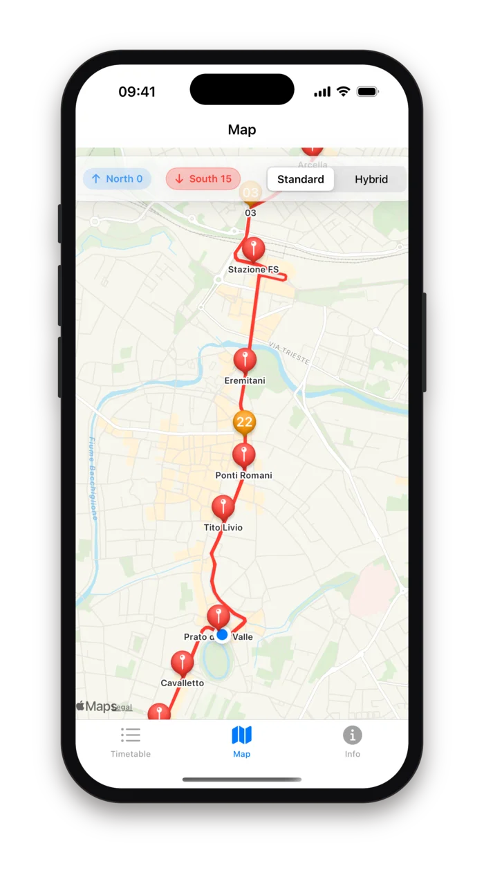
Three tabs, no settings
The timetable at the stop tells you when the tram should come. This app tells you when it will. The operator publishes the position of every vehicle and its predicted arrival at every stop, and Tram Padova turns that stream into two views: a list, for the stop you are standing at, and a map, for the tram you are waiting for.
There is nothing to configure. Location permission, granted once, picks the nearest stop and draws the walking route. Direction and map style are two switches at the top of the screen, and the app remembers them.
Timetable
Every stop of the line in one direction, nearest first in view, with the next trams and their delay as the operator predicts them right now.
Map
The line, the stops and the trams themselves, moving. Standard or satellite, north or south, and a walking route to any stop you tap.
Info
Version, a link for feedback, the privacy policy and the one-paragraph disclaimer. That is the whole third tab.
The stop you are at
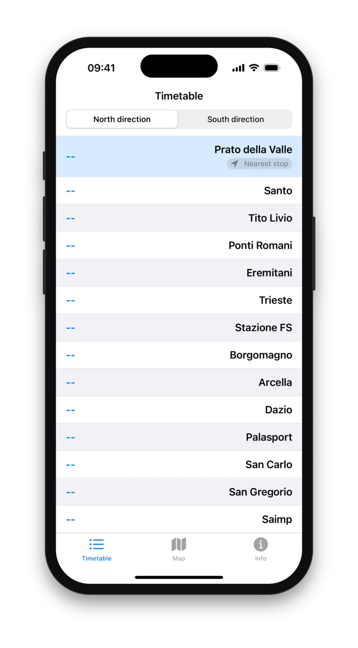
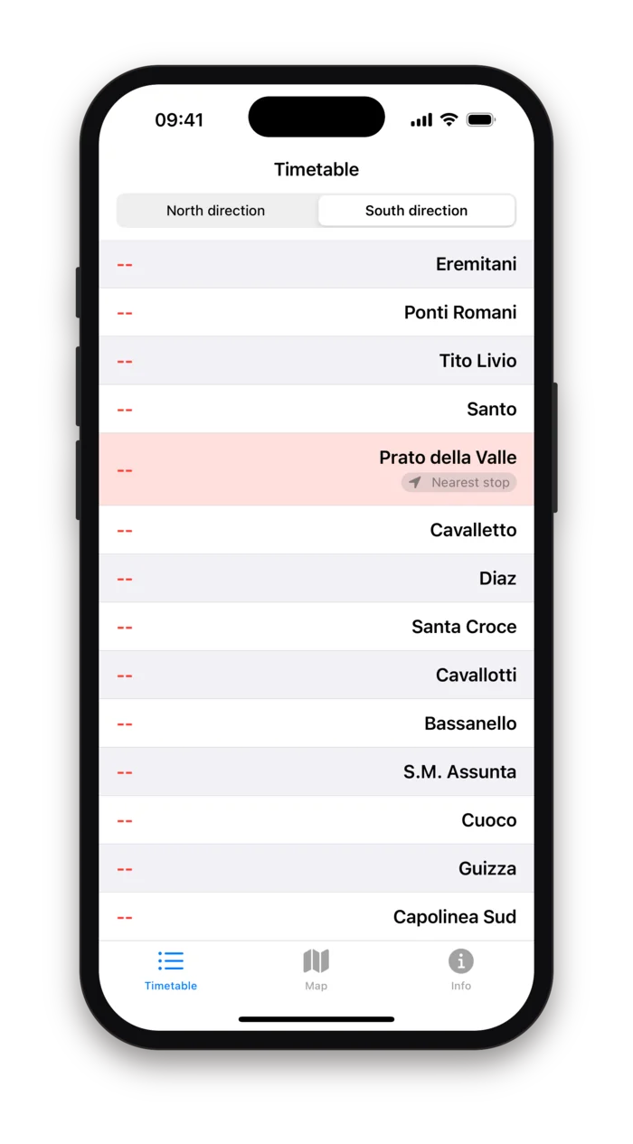
The Timetable tab lists the 25 stops of the chosen direction in order along the line. The nearest one is tinted, labelled "Nearest stop" and scrolled into view as you move. Each row shows the next trams for that stop, up to three, as they are predicted right now.
- North or South
- A switch at the top chooses the direction: northbound from Capolinea Sud at Guizza to Capolinea Nord at Pontevigodarzere, or the reverse. The list is tinted blue one way and red the other, like the line on the map.
- Nearest stop
- With location allowed, the stop closest to you is tinted, badged and scrolled to the top as you walk. Without it the list simply starts at the terminus.
- Up to three arrivals
- Each line is a vehicle number, the predicted arrival as a clock time, and a delay badge when the tram is off schedule: +2m, −45s. Times refresh as the feed does, every few seconds.
- Dashes mean no prediction
- When the operator is not publishing a prediction for a stop, overnight or during a disruption, the row shows two dashes. The app never fills the gap with a timetable guess.
The tram you are waiting for
The Map tab draws the whole line through the city, blue for northbound and red for southbound, with a pin at every stop and an orange marker for every tram carrying its vehicle number. Positions arrive every few seconds and the markers glide between them, so you can watch your tram leave the previous stop.
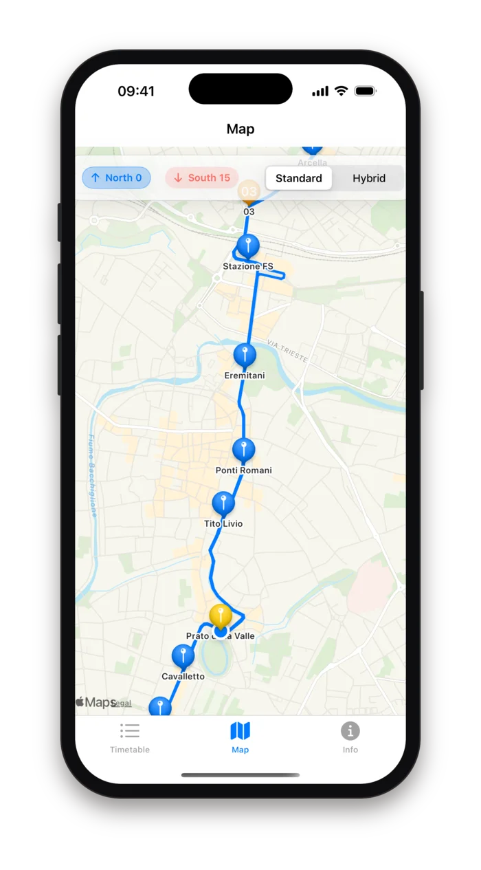
Northbound
Blue line, blue pins, and the nearest stop in yellow. The header counts the trams currently heading each way.
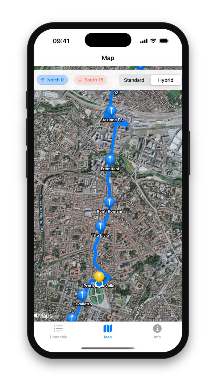
Hybrid
Satellite imagery under the same line and pins, for finding the actual platform among the streets and the rooftops.
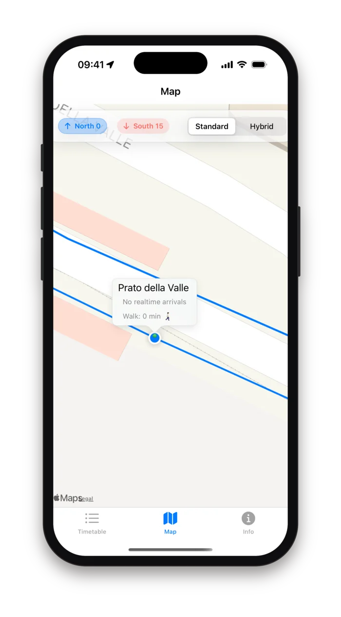
Tap a stop
The callout shows the next arrivals and a Walk button with the time on foot from where you are. Tap it and the route is drawn in green; tap again to hand over to Apple Maps for turn-by-turn directions.
The two buttons in the header, North and South, each show how many trams are currently running that way and switch the map between the two directions. The yellow pin is the stop nearest to you.
Where the data comes from
Busitalia Veneto, the operator, publishes the tram's vehicle positions and trip updates as public GTFS-Realtime feeds. A small service of ours reads both feeds every ten seconds and writes one document with the current state of the line; every open copy of the app is subscribed to that document and receives each change as it happens. The phone never has to poll, and the operator's servers see one reader instead of thousands.
Two feeds, one line
Vehicle positions give latitude, longitude, bearing and the vehicle number; trip updates give the predicted arrival and delay at each stop. Both are read every ten seconds.
Pushed, not polled
The app keeps a live subscription to the current state of the line and redraws when it changes. Opening the app shows the last known state at once, then the next update a few seconds later.
Direction from geometry
The feed's own direction flag is unreliable on a branched network, so a tram is called northbound when the last stop of its trip is north of the first.
Smooth markers
Between two positions the marker is animated over the time that passed since the previous one, from one to twelve seconds, so the tram slides along the line instead of jumping.
Only what the operator publishes
If a tram is missing from the feed, it is missing from the map. If no prediction is published for a stop, the row shows dashes. Nothing is simulated.
Clock times, not countdowns
Arrivals are shown as 18:42 rather than "in 6 min", so a stale prediction is visible as such and the list does not need to tick.
Two hours ahead at most
Predictions more than two hours away or more than a minute in the past are dropped. Overnight the list is empty because the line is.
The map needs the network
Tiles come from Apple Maps and the data from our feed. Without a connection the app shows the last state it received and nothing moves.
Your position is used, not kept
The app asks for location permission while in use, and only to measure the distance to the stops and to ask Apple Maps for a walking route. The fix is never stored and never sent to us. There is no account, no advertising and no analytics.
Location, while in use
Used to find the nearest stop and, when you ask for a route, sent to Apple Maps as the start of a walking direction request. The app does not store it and we never see it.
One read-only feed
The app reads the state of the line from our service and writes nothing back. Opening it creates an anonymous session so the feed can be read; there is no account and no profile.
No account, no sign-in
Nothing to register, nothing to remember. Direction and map style are kept in the app's settings on the phone.
No ads, no analytics
No advertising SDK and no usage analytics. The privacy policy linked below is the whole of what the app does with data.
Who it is for
Commuters
The same stop every morning. Open the app, see whether the 8:12 is on time or four minutes behind, and leave the house accordingly.
Students
From Arcella or Guizza to the centre and back at odd hours, with the next three trams at a glance and the walk to the nearest stop timed.
Visitors
Off the train at Stazione FS and into the city: the map shows the line, the stops and the tram that is about to arrive, in English.
Anyone who would rather not wait
In the rain, in August, with shopping. Knowing the tram is still at Ponti Romani is worth a few more minutes indoors.
Tram Padova first appeared on the App Store in 2010, when the tram was five years old. Version 3.3, from January 2026, is a complete rewrite in SwiftUI on the operator's current public feed, and the app is still free and still without advertising.
Leave the house when the tram leaves the previous stop.
Tram Padova is a free, independent app made for information and not for profit. It is not affiliated with, sponsored or approved by the transport operator or any public body. Positions and arrival times are the operator's own real-time predictions, relayed as published; when the feed is silent, at night or during a disruption, the app shows no times rather than guessing. Check the official timetable for service changes.